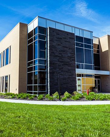
Hammond Campus Map

From the Student Union and Library Building to the Fitness and Recreation Center, find key locations on PNW’s Hammond campus with our official map.

Printable PDF Map

Text Description: Purdue University Northwest Hammond Campus Map

Area Map

The Purdue University Northwest Hammond Campus is bordered by 169th Street on the north, Woodmar Avenue on the west, Wicker Avenue on the east. The far south end of the campus is bordered by Interstates 80/94 and 173rd Street cuts through the lower third of the campus.

Four buildings are located outside these borders. They include:

  • the Roberts Center for Innovation & Design in Engineering Technology, at 7040 Indianapolis Boulevard
  • the Indianapolis Blvd. Counseling Center, housing the Couple and Family Therapy Center and Community Counseling Center, at 7030 Indianapolis Boulevard
  • the Commercialization and Manufacturing Excellence Center at 7150 Indianapolis Boulevard
  • the Purdue Northwest Athletics Complex at Dowling Park, at 175th and Parrish Avenue.

Campus Map

Academic Buildings

Many of the main academic classroom buildings are located along Woodmar Avenue, south of 169th Street and north of 171st. Traveling south from 169th Street in the Northwest Corner of campus, along Woodmar Avenue, you will find

  • the Anderson Building,
  • the Classroom Office Building
  • the Powers Building
  • the Potter Building
  • and the Gyte Building.

Directly east of the Gyte Building, north of 171st Street is Porter Hall.

Student Union and Library Building | Lawshe Hall

The Student Union & Library, including dining facilities, the Welcome Center and the PNW Library is located south of the academic buildings. Administrative offices are in Lawshe Hall, on Woodmar, north of 173rd.

Nils K. Nelson Bioscience Innovation Building

The Nils K. Nelson Bioscience Innovation Building is located just south of the Student Union and Library Building.

University Services

The University Services Building is located just south of 169th Street to the Northwest of Wicker Avenue.

Schneider Avenue Building and University Police

On the northeast side of the campus, the Schneider Avenue Building is located on Schneider Avenue south of 169th Street and houses administrative and academic offices. The University Police Station is located on the east side of the Schneider Avenue Building, with the entrance off Osborn Avenue.

South Campus

South campus is bordered by 173rd Street on the North and Interstates 80/94 to the south. Moving south from 173rd, east of Woodmar, you will find

  • the Fitness and Recreation Center
  • the White Lodging Center for Hospitality and Tourism Management building which also houses the Challenger Learning Center.

University Village Housing is located to the east of the Fitness Center, with Peregrine Hall and Griffin Hall.

Parking

Most of the parking on campus is open, with some restricted lots near Lawshe Hall. Parking lots on the north campus are available just south of the University Services Building and the University Police Station, and east of the Anderson, Classroom Office and Potter buildings. The 169th Street Parking Garage is located at the corner of Wicker Ave and 171st Street.

Parking is available south of the Nils K. Nelson Bioscience Innovation Building and south and east of Lawshe Hall, north of 173rd.

There is additional parking outside the Fitness Center and University Village Housing, south of 173rd.

Map of the Hammond Campus. Parking lots from 1 to 11 along with Peregrine Path connecting various buildings, the Design Studio, etc. are located between Woodmar, 169, 170, 171, and 172nd streets in the north. Across 173rd street, the parking lot from 12 to 15 along with Counseling Center, Center for Healthy Living, etc. are located in the south. An inset map of off-campus sites showing the PNW campus with various centers marked as 1, 2, and 3 in the west and 4 in the southeast.


Map of the Hammond Campus. Parking lots from 1 to 11 along with Peregrine Path connecting various buildings, the Design Studio, etc. are located between Woodmar, 169, 170, 171, and 172nd streets in the north. Across 173rd street, the parking lot from 12 to 15 along with Counseling Center, Center for Healthy Living, etc. are located in the south. An inset map of off-campus sites showing the PNW campus with various centers marked as 1, 2, and 3 in the west and 4 in the southeast.

What’s the Peregrine Path?

The Peregrine Path is the exterior pathway between Lawshe Hall and the Gyte Building and the interior corridor that runs from the Gyte Building through the Powers Building, Potter Building and Classroom Office Building to the Anderson Building.

Map of the Hammond Campus. Parking lots from 1 to 11 along with Peregrine Path connecting various buildings, the Design Studio, etc. are located between Woodmar, 169, 170, 171, and 172nd streets in the north. Across 173rd street, the parking lot from 12 to 15 along with Counseling Center, Center for Healthy Living, etc. are located in the south. An inset map of off-campus sites showing the PNW campus with various centers marked as 1, 2, and 3 in the west and 4 in the southeast.

Off-Campus Sites

  1. Indianapolis Blvd. Counseling Center
    Couple and Family Therapy Center
    7030 Indianapolis Blvd., Hammond
  2. Center for Innovation & Design in Engineering Technology
    7040 Indianapolis Blvd., Hammond
  3. Commercialization and Manufacturing Excellence Center
    7150 Indianapolis Blvd., Hammond
  4. Purdue Northwest Athletics Complex at Dowling Park
    175th & Parrish Avenue, Hammond

Resources

Westville Campus

See the layout of PNW’s Westville campus, from Schwarz Hall to the Dworkin Student Services and Activities Complex!

Gabis Arboretum

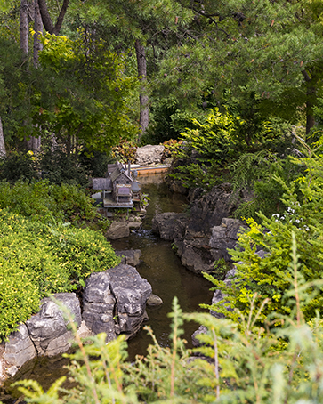
Gabis Arboretum at Purdue Northwest is a 300-acre, oak preserve of formal gardens, woodlands, wetlands, prairies and hiking trails located near Valparaiso, Indiana

Parking Lot 2 in Westville

Parking

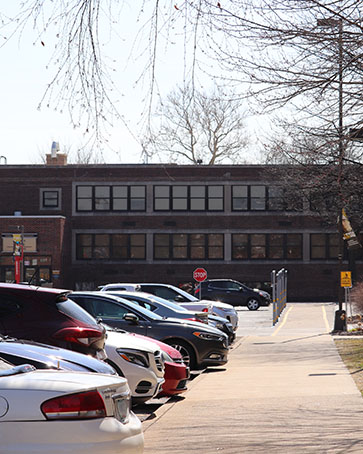
Explore parking options on PNW’s campuses, from open parking for students to paid parking for PNW employees.